If you have a need to produce a map with a range of circles to indicate a series of radius from a central point, our Concentric Circles Map can be used.
This can be useful when it comes to estimating delivery zones or delivery charges for fast food delivery series for example.
In order to use the Concentric Circles Map, it is necessary to add lines of text with a particular format to the text box below the map. We will now show a few examples of how this can be done:
First, you need to browse to the page http://www.freemaptools.com/concentric-circles.htm
The format of each line is:
[Location] , [Start Radius] , [End Radius] , [Colour]
Where:
- [Location] is the location of the centre point inside a pair of double quotes. This can be a place name or a latitude / longitude value
- [Start Radius] – The radius where this concentric circle starts
- [End Radius] – The radius where this concentric circle ends
- [Colour] – The fill colour of the radius.
You can add one or many lines depending on how many concentric circles you require. We will now show a few examples of how this can be used.
Example 1: Delivery Zones in London
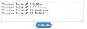
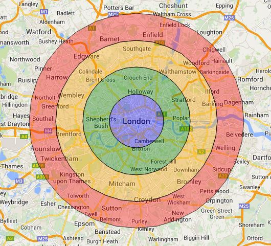
If we wish to express 4 delivery zones in London, England, each 5km apart, we can use the lines:
“London, England”,0,5,Blue
“London, England”,5,10,Green
“London, England”,10,15,Orange
“London, England”,15,20,Red
i.e.:
This will produce the following Concentric Circle Map:
Example 2: 100 mile to 150mile Range From New York
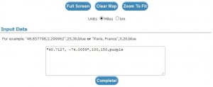
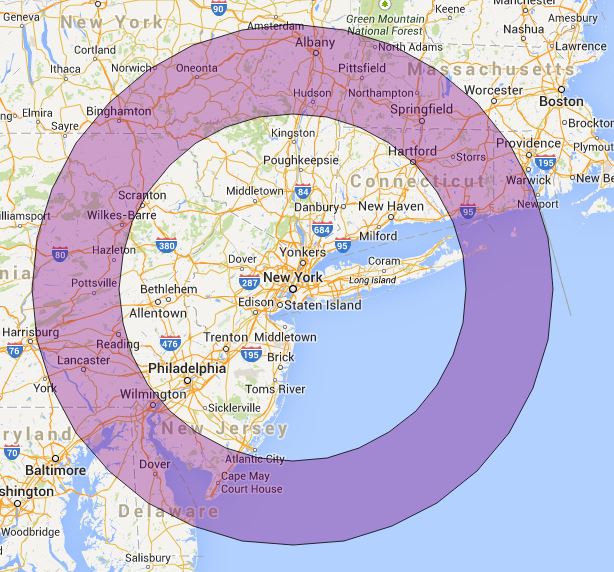
If we wish to illustrate an area between a 100 and 150 miles radius from New York with latitude/longitude of 40.7127, -74.0059 in purple, we could use the following line:
“40.7127, -74.0059”,100,150,purple
i.e.
Note: You can specify the units on the map. You can also use the Full Screen button to show the map in full screen mode.
This will produce the following map:
To create your own Concentric Circles, please visit the Concentric Circle Map page and try it yourself!


