This article will describe how you can use Free Map Tools Find Population on Map to produce an estimate for the population inside a radius.
- Go to the page Find Population on Map
- Ensure the radius search is enabled

This article will describe how you can use Free Map Tools Find Population on Map to produce an estimate for the population inside a radius.
You can use the Find Population on Map tool to draw a radius or area and then find out the population inside that area.
To start, click either the radius or area icon.
Need to find a list of US Cities found inside a radius from a center point?
Using Find ZIP Codes Inside a Radius you can do this quickly. We will show an example of all cities in a 50mile radius of Denver, Colorado.
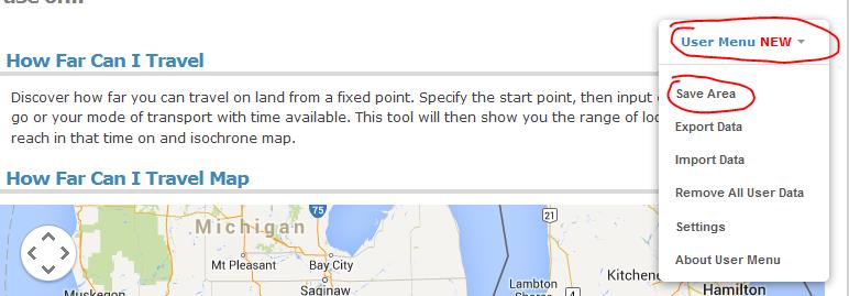
Following the addition of our new User Menu feature, we can show an example of how to use multiple pages on Free Map Tools and share data between them.
This scenario, is to list the USA ZIP codes within a ‘drive time’ radius. In this example we will find all ZIP codes within a 2 hour drive from Detroit, USA.
Procedure:

Your ZIPs are now returned!
Please use this example a basis for your own needs and uses across different pages on Free Map Tools
You can see how data is compatible between pages on https://www.freemaptools.com/about-user-menu.htm#featuretable