Frequently Asked Questions
Yes, you can enjoy Free Map Tools without ads.
We offer an ad-free experience for users who choose to support the site through a Memberful subscription. To go ad-free, simply visit the link below:
Once signed up, you'll be able to log in and use all Free Map Tools pages without any display ads.
Q: Thanks for providing this service, can I buy you a virtual beer or coffee?
A: Many thanks for the offer, you can donate using the PayPal button below:
We'd also appreciate if you could:
- Whitelist freemaptools.com on your ad blocker
- Add a link to Free Map Tools from your site or blog
- Tell colleagues or professionals about Free Map Tools
- Download the Free Map Tools iOS app
- Tweet about Free Map Tools
- Like us on Facebook
- Follow @FreeMapTools on Twitter
1. Switch to full screen view.
2. Use your browser's print function and adjust scaling.
3. Use landscape orientation for better fit.
Pan
Drag the map or use the pan buttons:

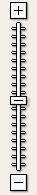
Zoom
Use the zoom slider:
Map Type
Use the map type buttons:
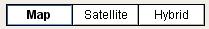
- Map – Basic map view.
- Satellite – Real-life satellite imagery.
- Hybrid – Combo of map and satellite views.
Troubleshooting
- Close and reopen your browser.
- Clear your browser cache and reload.
- Try another browser.
- Try a different device.
Still not working?
Please contact us and include:
- Page URL
- Error/problem details
- Steps to reproduce
- Your browser & OS
- A screenshot if possible
You can generate a citation for this website below in Harvard, APA, or MLA format.
Comments
Hi Tatum, just to be 100% sure, can you confirm the page (tool) you are using and perhaps send/link a screenshot of when this happens? Thanks
Hi. This map is excellent. I am wondering if I snap the zip code labels somehow to not overlap each other? Thank you.
Which data you use? How many GCPs you took for validate the data? How much is your accuracy?
Am I allowed to use this as a tool for mapping on Open Street Map?
When I use the new radius on the map tool, I can't click where I want the center of the radius. Whenever I click, I can only hold the map and move it.
How can I get a download link to the photo I have changed it gps?
How do I hide the distance / the location labels ?
The altitude map does not seem to be working.
Hello, is it possible to get a file of distances from a fixed starting postal code to all other postal codes within Canada?
Can you tell me the data source for the UK population data please
Hi. How can I use API? I need "Find Cities Within Radius Map" API if it exists.
Are the elevations reported in elevation-finder geopotiential elevation or height-above-ellipsoid?
Which Api you use to do the zipcode generation by radius?
Upload should be working again
can i upload my selected zip codes to my pc? not sure what KML means, but when i do a upload it just sits and thinks
Hi Chelsea, which page are you inputing the coordinates? Usually the format is latitude,longitude. For example the Eiffel Tower would be 48.8582701,2.2943991
I was wondering what format to put latitude and longitude coordinates? I cant seem to get it to work.
Really liking the plot airport routes map... Thanx Would like to help in anyway I can. Can't really donate so if there's something one could help with, let me know. Great job!
Can you tell me how accurate this information is and when the population census was last updated?
Lachie, which page/tool are you referring to?
Showing the most recent 20 of 119 comments. See all comments.